

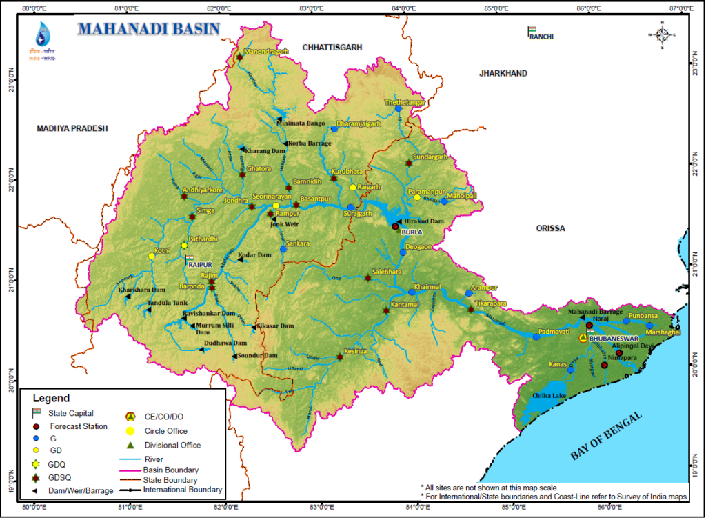
According to the Water Resources Information Systems of India, the Mahanadi basin extends over states of Chhattisgarh and Odisha and comparatively smaller portions of Jharkhand, Maharashtra and Madhya Pradesh, draining an area of 1,41,589 Sq.km which is nearly 4.3% of the total geographical area of the country. The geographical extent of the basin lies between 80°28’ and 86°43’ east longitudes and 19°8’ and 23°32’ north latitudes. The basin has maximum length and width of 587 km and 400 km.
It is bounded by the Central India hills on the north, by the Eastern Ghats on the south and east and by the Maikala range on the west. The Mahanadi is one of the major rivers of the country and among the peninsular rivers, in water potential and flood producing capacity, it ranks second to the Godavari. It originates from a pool, 6 km from Farsiya village of Dhamtari district of Chhattisgarh. The total length of the river from origin to its outfall into the Bay of Bengal is 851 km. The Seonath, the Hasdeo, the Mand and the Ib joins Mahanadi from left whereas the Ong, the Tel and the Jonk joins it from right. Six other small streams between the Mahanadi and the Rushikulya draining directly into the Chilka Lake also forms the part of the basin. The major part of basin is covered with agricultural land accounting to 54.27% of the total area and 4.45% of the basin is covered by water bodies.
River System
Mahanadi rises from Raipur district of Chhatisgarh and flows for about 851 km before its outfall into the Bay of Bengal. Its main tributaries are the Seonath, the Jonk, the Hasdeo, the Mand, the ib, the Ong and the Tel.
| Salient Features of Mahanadi Basin | |
| Basin Extent Longitude Latitude |
80° 28’ to 86° 43’ E 19° 8’ to 23° 32’ N |
| Length of Mahanadi River (Km) | 851 |
| Catchment Area (Sq.km.) | 1,41,589 |
| Average Water Resource Potential (MCM) | 66,880 |
| Utilizable Surface Water Resource (MCM) | 50,000 |
| Live Storage Capacity of Completed Projects (MCM) | 12,799.0 |
| Live Storage Capacity of Projects Under Construction (MCM) | 1465.0 |
| Total Live Storage Capacity of Projects (MCM) | 14,244.0 |
| No. of Hydrological Observation Stations (CWC) | 39 |
| No. of Flood Forecasting Stations (CWC) | 4 |
Source: India-WRIS